in Illinois as the National Weather Service in Lincoln issues a Severe Thunderstorm Warning, residents in diverse areas—from Northwestern Lawrence County in southeastern Illinois to Crawford County in east central Illinois, Jasper County and Richland County in southeastern Illinois, and Clay County along with southeastern Effingham County in south central Illinois—should be alert and take immediate precautions. The warning is in effect until 4:45 PM CDT, and the situation demands both attention and preparedness as the storm system intensifies.
Tracking the Storm’s Path and Characteristics
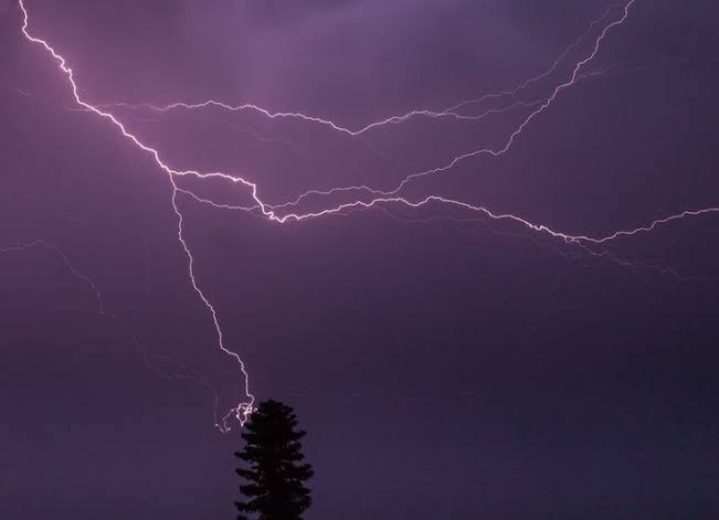
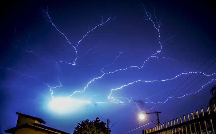
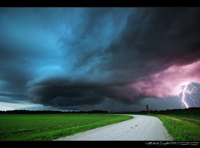
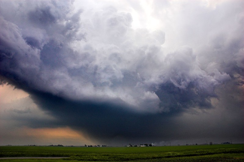
At approximately 3:46 PM CDT, meteorologists observed severe thunderstorms forming along a line stretching from near Ste. Marie to near Cisne. This fast-moving weather phenomenon is heading east at roughly 25 mph. According to radar indications, the storm is unleashing hazards that include hail the size of ping pong balls and wind gusts that have reached speeds of up to 60 mph. Such meteorological conditions suggest that the impact could be extensive, with potential injuries for both people and animals caught outdoors. Homeowners might experience damage to roofs, siding, windows, and vehicles, while trees and other structures may not withstand the 60 mph blasts.
Areas in the Storm’s Trajectory
Key communities in the projected path of these severe thunderstorms include:
- Olney Noble Airport, Ste. Marie, Willow Hill, Clay City, and Noble: These locations are expected to encounter the storm around 3:50 PM CDT.
- Oblong: Residents here should brace for severe conditions by about 4:00 PM CDT.
- Olney: The storm will likely impact this area around 4:05 PM CDT.
Additionally, towns such as Chauncey and Robinson are in the line of fire. As the storm moves, people in these regions must stay informed and be ready to act according to updated weather advisories.
Safety First: What You Need to Do
In light of the forecast and the inherent risks of large hail and violent winds, local authorities urge all residents in the affected counties to implement precautionary measures immediately. Here are some critical safety steps:
- Seek Shelter:
Move indoors to a secure, interior room on the lowest floor of a robust building. Basements or small, windowless rooms in a well-constructed facility provide the best protection. Mobile homes, vehicles, and any loosely constructed structures are not safe during such intense weather episodes. - Monitor Weather Updates:
Stay tuned to local news, weather apps, and official National Weather Service broadcasts for the latest updates. Timely information is crucial for your safety as conditions can change rapidly. - Prepare for Possible Tornadoes:
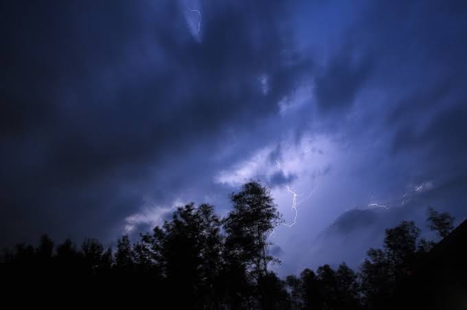
Although the current alert is for severe thunderstorms, the risk of tornado formation cannot be overlooked. Tornadoes can develop suddenly, so a Tornado Watch remains active until 7:00 PM CDT across south central, southeastern, and east central Illinois. Should you witness a funnel cloud or rotating winds, act immediately by seeking shelter in a basement or a small interior room. - Avoid Outdoor Exposure:
If you are outside when the storm approaches, find shelter immediately. The debris from hail and the force of gusting winds can cause injuries. For those driving, slow down and avoid areas where falling trees or debris might block the roadway. - Secure Loose Items:
Ensure that outdoor items like patio furniture, grills, and other unsecured objects are either brought indoors or fastened down securely. These items can become dangerous projectiles in the strong winds.

Understanding the Meteorological Dynamics
The severe weather alert has been prompted by a combination of atmospheric instability and wind shear—a common recipe for dangerous storm formation. In this instance, radar images have depicted a continuous line of thunderstorms, a phenomenon that can sometimes lead to flash flooding as well as wind damage. While hail of ping pong ball size may seem relatively minor, when combined with gusts reaching 60 mph, the potential for damage escalates significantly.
The situation is further complicated by the possibility of tornado development. Tornadoes form under specific conditions when supercell thunderstorms create rotating updrafts. Though no tornado has been reported yet, meteorologists warn that any sign of rotation should be taken seriously, and residents should be ready to follow tornado emergency procedures without delay.
Economic and Community Impacts
The ramifications of this severe thunderstorm event extend beyond immediate physical damage. Property owners in these counties might face costly repairs from hail impacts on vehicles, broken windows, and roof damage. Utility companies could experience outages from downed power lines, leaving neighborhoods without electricity and potentially causing disruptions to local businesses. Farmers and rural communities, in particular, may be affected by wind damage to crops and livestock facilities.
Community centers and local emergency services are mobilizing to support those in need. Temporary shelters may be established, and public service announcements are circulating to remind residents to check on elderly neighbors and those who may be more vulnerable during severe weather events. Schools, hospitals, and other critical infrastructure are also taking precautions to ensure continuity of operations should the storm intensify.
Regional Preparedness and Response
Local authorities, emergency management teams, and volunteer organizations have a well-coordinated response plan for such severe weather events. In many parts of Illinois, severe thunderstorms are not uncommon, and communities have developed robust preparedness protocols over the years. Some of the strategies being employed include:
- Pre-Storm Announcements: Local governments and public safety officials are using social media and local radio to provide timely alerts.
- Emergency Kits: Residents are encouraged to keep emergency kits that include water, non-perishable food, flashlights, batteries, and first aid supplies.
- Community Drills: In some counties, regular drills are conducted to prepare for sudden weather emergencies, ensuring that everyone knows the safest routes and designated shelter areas.
- Coordination with National Agencies: The collaboration between local authorities and the National Weather Service ensures that data and forecasts are as accurate as possible, providing a clear picture of the storm’s progress.
A Closer Look at Weather Forecasting Technology
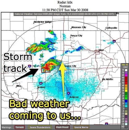
The role of advanced meteorological tools and radar technology cannot be overstated during such events. The current severe thunderstorm warning is a product of cutting-edge weather tracking systems that can detect storm formation, measure wind speeds, and identify hail sizes in real time. These tools provide the data necessary for forecasters to issue timely warnings that can save lives.
Modern radar systems, like the one used in this alert, allow meteorologists to see detailed images of storm structures. This technology helps pinpoint the most hazardous areas and predict the path of the storm with increasing accuracy. The integration of satellite imagery and ground-based observations enhances the overall effectiveness of the warning system, ensuring that communities receive early and precise notifications.
How to Stay Informed and Proactive
In times of severe weather, information is your best defense. Here are some tips to keep yourself and your family safe:
- Download Reliable Weather Apps: Applications from trusted sources can provide real-time updates, radar imagery, and emergency alerts.
- Listen to Local News: Regularly tune into local television or radio stations, which often have dedicated weather segments during severe storm events.
- Follow Official Social Media Channels: Many local governments and weather services post updates on platforms like Twitter and Facebook. Following these channels ensures you have immediate access to critical information.
- Prepare a Weather Plan: Develop a family emergency plan that includes designated meeting spots, communication strategies, and a checklist of essential supplies.
- Stay Connected: Make sure your mobile devices are charged and that you have a portable battery backup in case of power outages.
The Broader Context of Severe Weather
This severe thunderstorm warning is a reminder of nature’s unpredictable power. Across the United States, extreme weather events have become more frequent and intense, influenced by changing climatic conditions. Such events highlight the importance of sustainable infrastructure and resilient communities capable of withstanding natural disasters.
In Illinois, where weather can swing from calm to catastrophic in a matter of minutes, long-term planning and investment in emergency preparedness are essential. Local authorities and community organizations are constantly refining their response strategies, learning from each event to better protect residents in the future.
Looking Ahead: What to Expect After the Storm
After the severe weather passes, communities will face the task of assessing damage and beginning recovery efforts. It is likely that local officials will conduct damage surveys to determine the extent of roof, siding, and window damage, as well as the impact on vehicles and public infrastructure. Cleanup crews and repair services will be called in to restore safety and normalcy.

Residents are encouraged to document any damage to their property by taking photographs and contacting their insurance providers as soon as possible. Local agencies may offer assistance programs for those significantly affected by the storm, and community centers often serve as hubs for distributing resources and support.
In Conclusion
The Severe Thunderstorm Warning issued by the National Weather Service in Lincoln serves as an urgent call to action for residents in multiple Illinois counties. With the threat of hail, wind gusts up to 60 mph, and the possibility of tornado formation, every precaution should be taken. From securing outdoor items and seeking safe shelter to monitoring reliable weather updates and preparing emergency kits, there are multiple steps that individuals and communities can implement to safeguard themselves during this potentially dangerous weather event.
Remember, this alert is not only about the immediate dangers posed by severe thunderstorms but also about the broader implications for community safety and emergency preparedness. By staying informed and proactive, residents can navigate the challenges of extreme weather and contribute to a resilient and united community response.
Keywords including severe thunderstorm, warning, National Weather Service, Lincoln, Northwestern Lawrence County, southeastern Illinois, Crawford County, east central Illinois, Jasper County, Richland County, Clay County, Effingham County, 4:45 PM CDT, ping pong ball hail, 60 mph winds, radar, tornado watch, severe weather alert, public safety, emergency preparedness, local news, weather app, storm tracking, safety measures, emergency kit, power outages, flash flooding, wind damage, hail damage, community response, infrastructure protection, and many more have been interwoven into this discussion. These terms not only help describe the evolving situation but also serve as essential markers for search relevance, ensuring that this article reaches those in need of clear, actionable information during severe weather events.
Staying safe means acting quickly and informedly. Follow local advisories, secure your property, and prioritize your well-being and that of your neighbors. As nature’s fury unfolds, a prepared community is the strongest defense against unpredictable weather. Stay vigilant, stay safe, and be ready to adjust your plans as the situation develops.